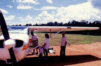
Fans of aerial combat
will remember how Allied bombers over Germany looked for holes in the clouds to
descend through and then looked for their targets. When flying in the early
mornings, I had to use the same
technique to reach some destinations. This manoeuvre is not without its risks,
so I avoid it as much as I can.
In the early nineties
the GPS for aerial navigation was still an expensive equipment, costing more
than RM4,000 each. We flew using only maps and the magnetic compass. As the
latter swings erratically and takes a long time to stabilise whenever an
aircraft changes direction, another instrument called the Directional Gyro
Indicator (DGI) is used. This is a more reliable instrument but the pilot has
to regularly feed in the headings that he reads from the magnetic compass into
the DGI which always "drifts" as time passes.
I was flying from
Sempang (the callsign for the RMAF base on Jalan Sungei Besi in Kuala Lumpur)
to Taman Negara in Pahang one cool morning. Taman Negara happens to be my favourite
weekend destination whenever I fly. It is only an hour's flight away and yet is
a thick tropical jungle protected by law and had existed for 130 million years
untouched by glaciers. It had clean rivers, cool waters and many rapids.
The sky was clear when
we left. Our flight plan was filed for Batu Caves, Bentong, Jerantut and then
Sungai Tiang which is the laterite airstrip located about five kilometres
downstream from Kuala Tahan, our eventual destination. It is the site of most
tourist amenities in the area. After Batu Caves, we passed Genting Highlands on our left and was
overhead Bentong airfield which in reality is a fairway on the Bentong golf
course. Overflying Bentong at our cruising altitude of 3,000 feet, we tracked direct for Jerantut which took us
to the right of and below the peak of the majestic Gunung Benum. However we
found that the cloud cover below us was thick and had blanketed the entire
terrain ahead of us leaving no landmark for us to refer to. Jerantut was up
ahead somewhere and we had to find it somehow since our subsequent leg to
Sungai Tiang was by following the Pahang River northwards beginning from
Jerantut.
We had an instrument on
board called the Automatic Direction Finder (ADF) which can be used to track a
radio signal from any radio station. This instrument is usually unreliable as
it will point to any electrical source nearby such as a cloud with an
electrical charge or some unknown radio transmission. Knowing that Jerantut has
a radio broadcasing station, I tuned the ADF to the station's frequency but
this time there was nothing heard and the needle pointer was rotating all over
the gauge.
There was no other
choice but to find a hole in the cloud below us and go down it to see what
landmark lay below that we could recognise. Comparing our elapsed flight time
and airspeed with our navigation log, we should have just passed Jerantut. Luck
was with us and a reasonably sized hole in the white substance below us was
nearby. We had to go through it quickly or it may close back leaving us
stranded in the sky. The C172 is not a fighter plane that can zip down a hole
just like that. I had no dive brakes. If I were to simply dive the plane
through the hole, the gravity would accelerate it to a speed beyond its limit
and rip its wings off. After checking with Air Traffic Control that no other
traffic was nearby, I put the plane into a shallow spiral dive with twenty
degrees flaps and kept the airspeed near the limit. Peeping through the hole I
could see flat terrain below, so there was no danger of hitting a hill or something.
After what felt like
hours, we finally were below the cloud which was just a thousand feet above the
ground. Visibility was good. I looked around and saw a river not far off,
headed towards it and from its size knew that it was the right river although
Jerantut was nowhere to be seen. We headed north along it confirming the layout
with that on our map. Further upriver there were familiar-looking boats that
added to my confidence that we were at the right river. Taking the correct
forks as we flew on, we finally saw the Sungai Tiang airstrip and landed.
I locked the plane up
and we walked to the jetty to wave down a boat, as I used to do, to take us on
a one and a half hour ride to Kuala Tahan. The cool breeze that blew as the
open boat trundled through the rapids was very welcome indeed (the normal
passenger boats usually have a canopy above to ward off the sun).
We lunched at
the usual cafe, walked around and then took another boat back to the
airfield. This time the warming earth
had pushed the morning's cloud layer up a couple of thousand feet to form fast
growing cumulus hills that will not only affect our visibility but also make
the flight home a bumpy one.


